


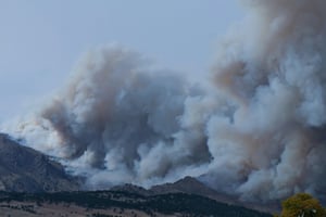
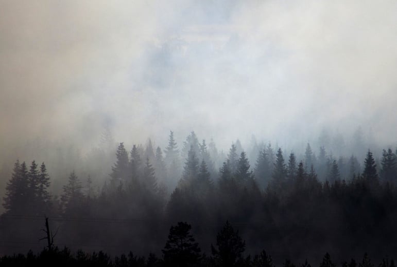
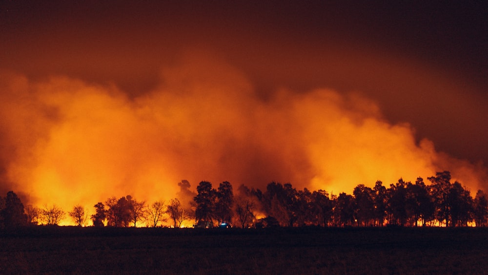
Wildfires are undoubtedly one of the easiest natural perils to spot with the naked eye. Whether it be a towering inferno of flames effortlessly burning through vegetation or thick plumes of smoke billowing high into the sky, wildfires are a very visible threat.
However, this surface-level look only tells a fraction of the story, particularly when it comes to understanding key information about a wildfire.
The naked eye cannot see through smoke, and due to factors such as temperature, radiation, and scattering caused by tiny smoke particles, nor can standard optical imagery formats. This makes it impossible to uncover vital information such as identifying a wildfire’s hotspots and worst-affected areas or predicting its movement.
As the frequency and severity of wildfires around the globe continues to rise due to climate change, poor land management and invasive species, the importance of multi-format/multi-height imagery that can penetrate the increasingly dense layers of smoke caused by abnormally large wildfires couldn’t be higher.
With this in mind, it seems prudent to highlight some different imaging formats and techniques that help to cut through the smoke and respond to wildfires more proactively and effectively.
Infrared
Though thick layers of smoke typically deny optical imaging formats even a glimpse of what’s happening underneath, the same cannot be said when observing a wildfire using infrared cameras.
Shorter wavelengths present in visible light are easily absorbed by smoke particles in the air, therefore blocking the view. As infrared waves have longer wavelengths, it means they can penetrate these dense plumes undisturbed, effectively rendering the smoke transparent.
Equally, infrared waves are less susceptible to the effects of fires such as elevated temperatures impairing vision, radiation saturating the images, and scattering caused by small particles in the air. As they don’t rely on visible light, there is much greater scope for applying infrared to low light or night-time scenarios, ensuring round-the-clock visibility of wildfires.
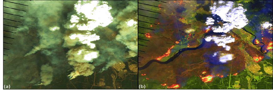
Wildfires and their impact appear in infrared images through assorted colours that represent various aspects in each situation. Fires and their hotspots will glow orange and yellow, burned vegetation appears in shades of dark orange or rust, and unaffected vegetation is blue, allowing for clear distinctions between affected and unaffected areas.
All these attributes make infrared imagery an essential tool for wildfire coverage, as it provides much greater insight into how a fire is behaving and in turn, enables a more effective response.
For instance, infrared imagery can quickly establish a fire's key traits, where a greater view of what’s happening on the ground can determine where the fire is burning at its hottest, the location of the flame front and identify individual structures and areas of highest concern.
Infrared enables much earlier detection and assessments of wildfires, where increased levels of ground truth mean that the focus can be on prioritising resources. This means that first responders can move safely through affected areas by tracking the fire’s movement and claims can be quickly processed without needing anyone on the ground.
It was estimated by Markets and Markets that the 2023 value of the infrared imaging market was $6.7bn, where a Compound Annual Growth Rate (CAGR) of 7.3% will see this value rise to $9.6bn by 2028. This will undoubtedly result in more innovative applications of infrared imagery and continue to improve responses to the increasing severity and frequency of wildfires worldwide brought by climate change.
The image below shows how a wildfire looks from above in a typical optical imagery format (a) and the same wildfire as seen through infrared imagery (b).
Synthetic Aperture Radar (SAR)
Although in isolation there is no denying the effectiveness of infrared compared to typical optical imagery, what really enhances wildfire response is the combination of multiple imaging formats that bring their own unique properties to the table.
In the last decade, the capabilities of radar satellites for imaging purposes have grown exponentially, with the advancement of synthetic aperture radar technology enabling intelligence to be collected from space at more regular intervals and crucially during either daytime or night-time hours.
SAR isn’t reliant on energy coming from Earth to piece together images, as the active sensors transmit their own microwave signals to highlight and capture specific objects or areas on the ground. This means that sensors are unaffected by any radiation caused by wildfires and can pass through smoke with ease, illuminating the surface below by returning (or backscattering) signals from the ground back to the satellite.
Using SAR to view wildfires from space is particularly useful for proactive monitoring, where there is enough detailed information to predict where and when fires will be at their worst. In turn, this enables insurers to have clarity on how their portfolios will be affected ahead of time, so they can plan their resource allocation accordingly.
SAR sensors also enable near-real time tracking of fires as they spread across affected areas, with the backscattered signals from Earth feeding the satellites with the latest information to understand how a fire is moving.
Backscattering can also be applied to measure the extent of the damage caused by fires, which provides immediate insight to insurers about which of their properties have been affected, subsequently allowing them to expedite their claims process and quickly get resources to those in need.
Given the expensive nature of developing satellite technology, it’s unsurprising that IMARC valued the SAR market at $3.8bn in 2022. The market is predicted to grow to $7.0bn by 2028 at a CAGR of 10.6% between 2023-2028, suggesting that its effectiveness and applications will only get better over the coming years, which will be useful as fires continue to burn with more intensity than ever before.
Visible Infrared Imagery Radiometer Suite (VIIRS)
Even though it has limitations in its ability to see through smoke compared to the previous two entries, using VIIRS sensors has fast become the primary method for detecting and tracking global fire activity.
VIIRS sensors harness 22 bands across the electromagnetic spectrum, where the mid-infrared and thermal bands are best suited for fire detection. They also possess day/night capability and are particularly useful for near-real time fire alerts and improved mapping fidelity, either through a closer look at smaller, lower temperature fires or outlining the perimeters of larger fires.
Currently equipped on the Suomi National Polar-orbiting Partnership (Suomi NPP) and NOAA-20 satellites, these VIIRS instruments follow a strict algorithm for remote-sensing thermal anomalies, offering frequent global coverage as they provide imagery roughly twice a day.
The algorithm works by identifying hotspots in the VIIRS imagery, seen as pixels displayed in 375mx375m resolution. These images will be run through the algorithm to determine if certain characteristics are consistent with those typically associated with a fire pixel, then subsequently highlight these fire pixels to provide a clear outline of where a fire is located.
Though sometimes smoke plumes can conceal fires in the typical pixel format, this can be circumvented by using true colour RGB VIIRS imagery, as it is much less susceptible to smoke’s effects and clear distinctions can be made through different aspects appearing in varying colours. True colour imagery is also available at 750mx750m resolution, therefore providing better coverage of any given area.
Ultimately, VIIRS imagery is an essential part of ongoing efforts to respond more proactively and effectively to wildfires, especially in terms of initial detection, mapping and tracking. However, there is insufficient data to predict its market value, given this is still relatively new technology and there are very few instruments in active use. Despite this, its scope is considerable and given it is already the primary method for global fire detection, is undoubtedly invaluable to those using it.
Multi-height collection
Whilst harnessing the ability to see through smoke is undoubtedly a major advantage, it is how these technologies are applied to collect imagery that enable maximum coverage of an event and a more effective wildfire response.
This is where it is necessary to commit to using multi-height imagery collection techniques that offer a much broader range of visibility whilst covering a larger surface area, so that insurers and authorities have a full picture of how a wildfire is behaving and its subsequent effects.
Typically, assessing wildfires from the air is a difficult proposition, given the limitations of the naked eye and smoke’s natural lack of transparency. However, with infrared cameras attached to aeroplanes or unmanned drones that can be flown over the scene of a fire at a safe height, they are able to get a clear picture of what is happening on the ground below.
Satellites take this one step further, where they offer a wider breadth of coverage from space and are completely immune to the dangers and drawbacks of trying to see through smoke. Using SAR allows for much greater oversight of a fire’s movements and effects whilst creating more opportunities to predict its path and undertake proactive monitoring.
Finally, whilst it may be the riskiest method for collecting imagery amid a raging wildfire, it is still essential that there is someone at the scene capturing crucial insight at ground level. Though of course this is where standard optical imagery formats have a larger part to play in wildfire response, the technology to cut through the smokescreen is vital as it enables those on the ground to navigate and monitor the fires from a safer distance.
MIS wildfire coverage
MIS has been at the forefront of collecting multi-source data and converting it into actionable intelligence for our clients since 2011. We know that while invaluable as a part of data collection, true and valuable intelligence cannot be gathered from a single source alone.
Harnessing all these different techniques, MIS have covered global fire events for several years, including monitoring the current Australian bushfire season, as well as responding to the 2021 California wildfires and last year’s major wildfires in Canada and Hawaii.
Via our data-led intelligence platform, the Global Events Observer (GEO), our team of NATO-trained analysts assess imagery and data from trusted global sources in the aftermath of wildfires, to provide insurers with the required insight to swiftly respond to those in need.
Within 24 hours of a fire, we can provide clients with an in-depth report and high-resolution imagery, followed by a detailed building-level damage assessment in just 72 hours. Following this, we continuously monitor the fire and will update GEO for the duration of the event.
Contact our team today to see what GEO can do for you.